About St Brandon Isle
St Brandon, together with the Islands of Agalega some 350 miles to the North, form the DXCC Identity Agalega & St Brandon Is ( 3B6 and 3B7)
Cargados Carajos Shoals (also known as the Saint Brandon Rocks) are a group of about 16 small islands and islets on an extended reef in the Indian Ocean northeast of Mauritius. The islands have a total land area of 1.3 km². The reef measures more than 50 km from north to south, and is 5 km wide, cut by three passes. The reef area is 190 km². The islands have a small population, made up of natives as well as others, and are rich in flora and fauna. The islands are classified as a dependency of Mauritius, which is more than 300 km south, and are administered from Port Louis. The islands are part of the Mascarene Islands.
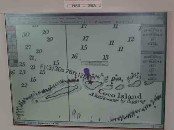
3B7C will be operating from Isle du Sud, which is part of Cocos Island (a mainly submerged reef). Isle du Sud is some 1300m long and 230m wide. The long shoreline runs East-West, which makes it ideal for an array of antennas pointing generally North- West through North to North-East. The island rises to a few metres above sea level, and is protected on the windward side by a reef, some 2 km out to sea.
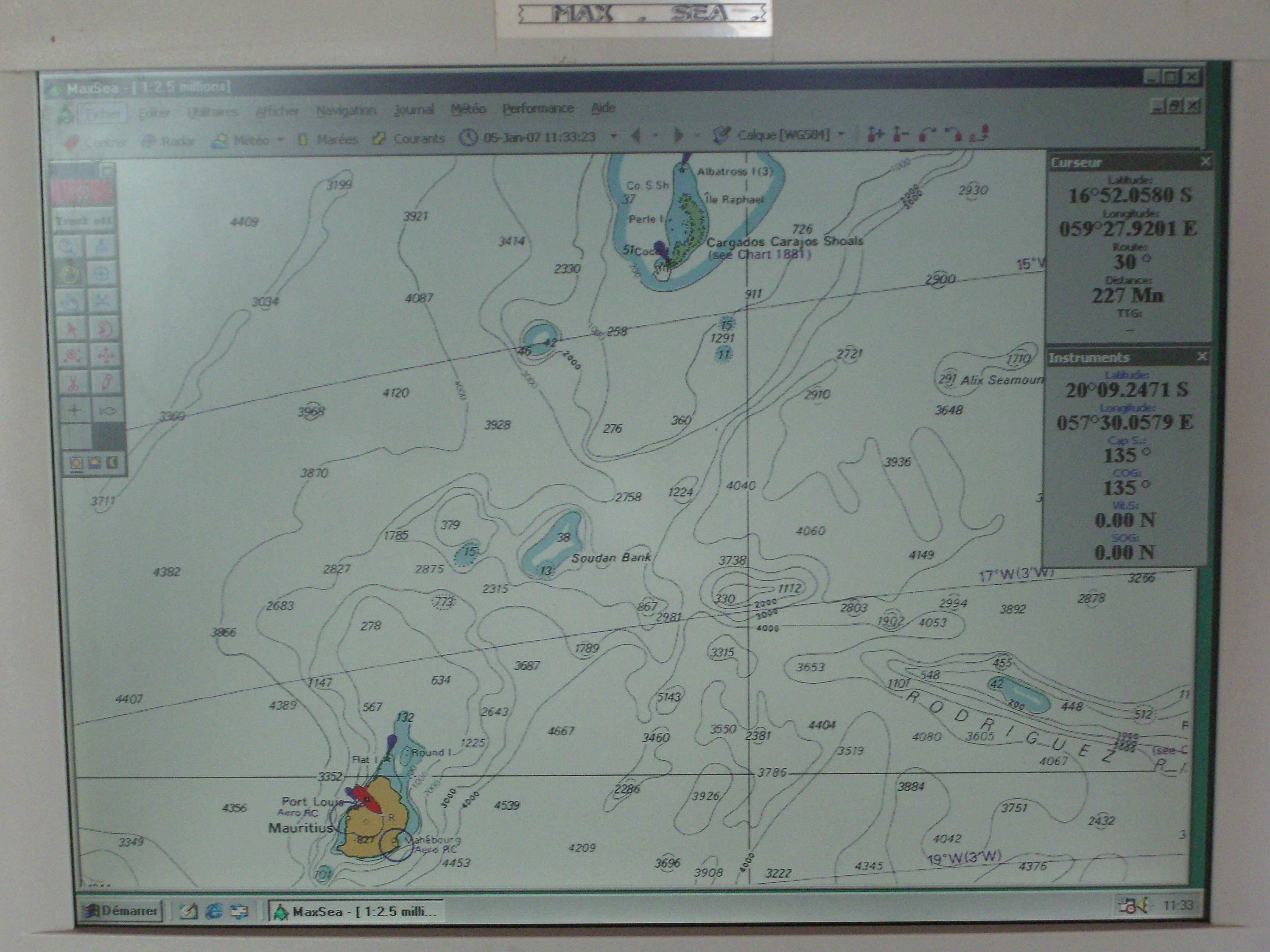
St Brandon is approached only by sea, and is some 240 nautical miles from Port Louis, Mauritius.
Below are two images from the navigation computer on the Sainte Rita, showing the routing and destination.